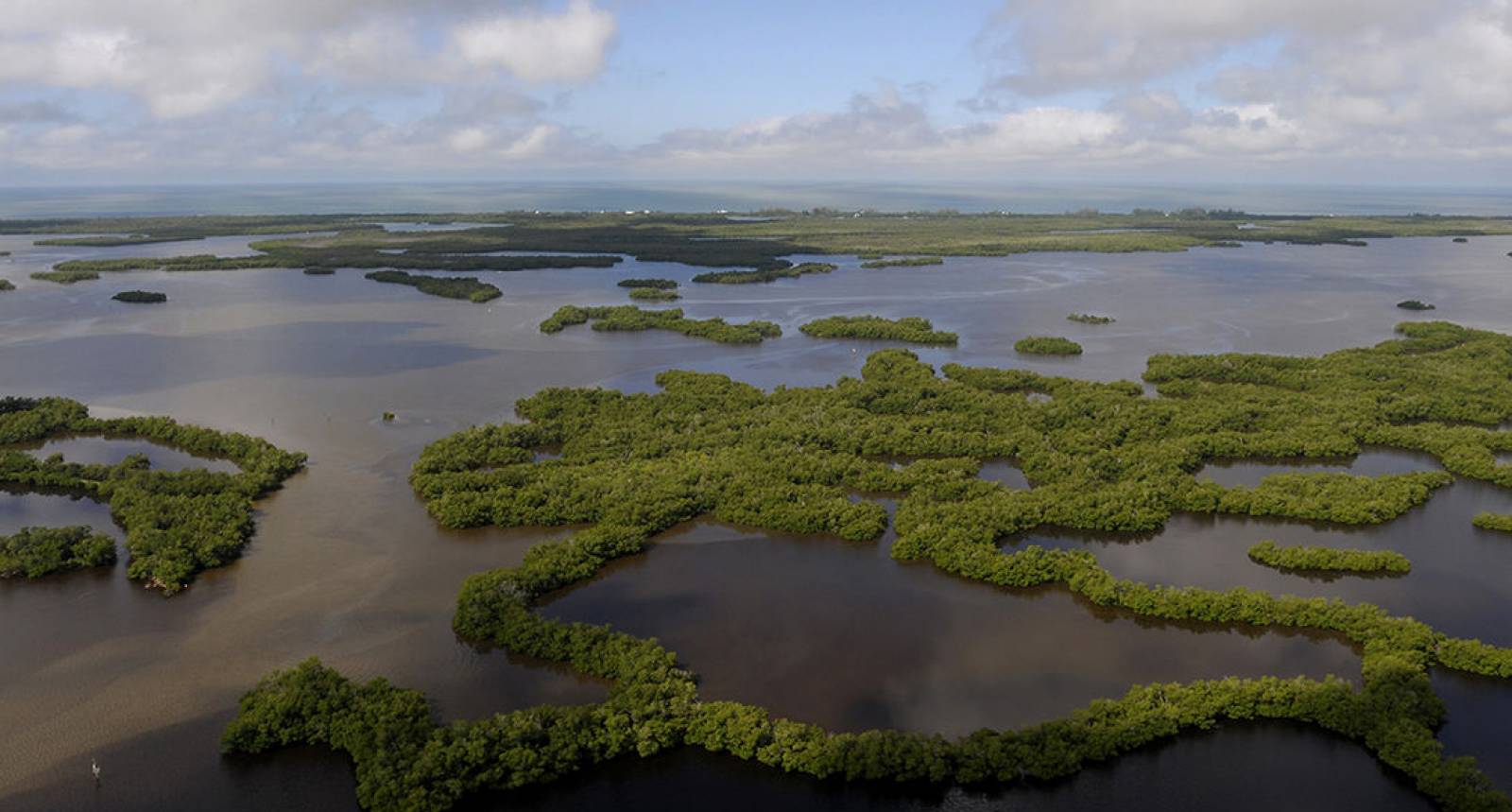
Simply put, estuaries connect the ocean and the land. Saltwater and fresh meet to become the brackish water that nature uses to foster life. Humans depend on both for their existence, so caring for both is vital. The 73,352 acres of salt marsh and mangrove tidal wetlands, oyster bars, estuarine lagoons, upland habitat and offshore seas that comprise The Guana Tolomato Matanzas National Estuarine Research Reserve make it a living laboratory for staff, scientists and graduate students.
The northernmost extent of mangrove habitat on the east coast of the United States, GTM offers some of the highest dunes in Florida, measuring 30-40 feet, and one of the few remaining "inlets" in northeast Florida not protected by a jetty, appearing exactly as it might have been in the distant past.
The GTM Reserve is divided by the city of St. Augustine, stretching approximately 30 miles north and 30 miles south of the city, in St. Johns and Flagler counties. The coastal waters of the GTM Reserve are also important calving grounds for the endangered Right Whale. (www.nerrs.noaa.gov/)
The beachfront of the GTM Reserve, including the next 10 miles of Atlantic Ocean, provides a shelling and shark tooth hunter’s treasure trove, especially after a storm. Shells, mermaid’s purses (egg cases) and shark’s teeth going back 60 million years are commonly found here. On the west side of A1A at13.6 miles, a boat ramp provides access to the Guana River as it meets the Intracoastal Waterway. Other public beach access points are located at 12.9 miles, 15.2 miles and 16.2 miles, with parking on west side of A1A (No accessible facilities). Next bathroom, fuel, and food facility are at 20.2 miles on the west side of A1A.
Want to know more? Visit www.dep.state.fl.us/coastal/sites/gtm/ for additional information.
Visitor Tip
9.4 miles: heading south on the byway.
Other GTM areas open to the public:
(Most are open 8:00 a.m. until sunset)
10.0 miles – beach access 1 – no facilities
10.6 miles – (west aide of A1A) – boat landing/access parking, no facilities
12.3 miles – mid-beach access – (west aide of A1A) parking, no facilities
13.2 miles – beach access – (west aide of A1A) parking, no facilities
Points Of Interest
- Ponte Vedra Beach
- Bird Island Park
- Mickler’s Landing
- Guana Tolomato Matanzas
- Guana Tolomato Matanzas Environmental Ed Center
- Nease Beachfront Park
- Vilano Beach
- Colonial St. Augustine
- St. Augustine
- The Flagler Factor
- America’s Tourism Capital 1890-1930
- Anastasia Island
- Fort Matanzas – National Monument
- Marineland and UF Whitney Lab
- Washington Oaks Gardens State Park
- Malacompra Plantation Archaeological Site
- Betty Steflik Memorial Reserve
- Flagler Beach Pier
- Gamble Rogers Memorial State Park